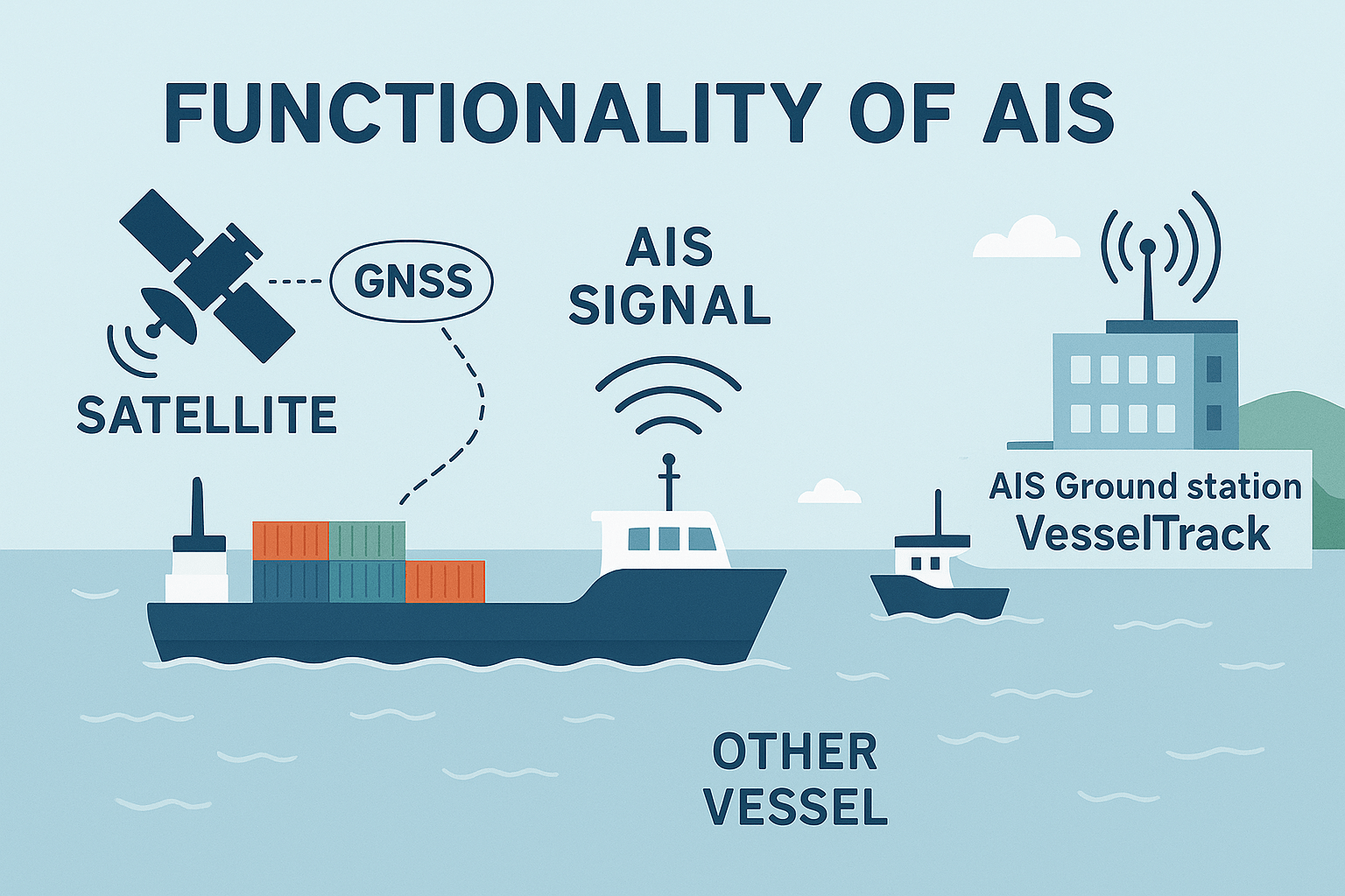
The Automatic Identification System (AIS) is a standardized maritime communication system that enables vessels to automatically broadcast critical information such as identity, position, course, and speed over VHF radio. Originally developed for collision avoidance, AIS has become a central pillar of maritime safety, navigation, and operational oversight.
The International Maritime Organization (IMO) mandates AIS carriage for:
- All passenger ships
- All commercial vessels ≥300 gross tonnage on international voyages
- Cargo ships ≥500 gross tonnage on domestic voyages
Smaller and recreational vessels may carry Class B AIS, which operates at lower transmission power and with reduced update rates.
How AIS Works – Technical Overview
AIS operates on VHF maritime channels (161.975 MHz and 162.025 MHz), using GMSK modulation and a 9.6 kbps data rate. Two main types of AIS transceivers exist:
- Class A (required for large vessels): Uses SOTDMA, transmits every 2–10 seconds while moving.
- Class B (optional for smaller vessels): Uses CSTDMA, transmits every 30 seconds to 3 minutes.
Each transmission includes standardized messages covering:
- Static data: MMSI, ship name, call sign, vessel type
- Dynamic data: Position, speed, course, heading
- Voyage data: ETA, draft, destination
- Binary messages: Alerts, weather reports, Aids-to-Navigation (AtoN) info
Transmission range typically spans 20–40 nautical miles via line-of-sight VHF, and can extend globally through Satellite AIS (S-AIS).
Who Uses AIS Data – And Why
AIS data is invaluable to a wide array of users across the public, private, and defense sectors:
- Commercial Vessels and Ship Captains use AIS to improve navigational safety, especially in crowded sea lanes or poor visibility. Real-time awareness of nearby ships helps prevent collisions and reduces reliance on radar alone.
- Port Authorities and Vessel Traffic Services (VTS) rely on AIS to monitor ship movements, manage docking schedules, and optimize port operations. By tracking vessels approaching and leaving ports, they can reduce congestion and improve turnaround times.
- Coast Guards, Border Agencies, and Navies use AIS for maritime surveillance, search and rescue coordination, and maritime security enforcement. Knowing the real-time position and identity of vessels aids in detecting suspicious behavior and responding quickly to emergencies.
- Fleet Operators and Shipping Companies monitor AIS data to manage logistics, plan routes, optimize fuel use, and analyze vessel performance. AIS-based analytics also support predictive maintenance and supply chain coordination.
- Environmental Agencies and Researchers use AIS to study maritime traffic patterns, assess the impact on marine ecosystems, and monitor activity in protected or restricted zones.
- Insurance Companies and Investigators analyze AIS records post-incident to reconstruct maritime accidents, verify claims, and evaluate liability.
The Strategic Role of Industrial and Defense AIS Ground Stations
While satellite AIS enables global coverage, terrestrial AIS ground stations—especially those designed for industrial or defense applications—offer key advantages:
- High-Resolution Data: Ground stations can receive AIS signals with higher fidelity, frequency, and spatial accuracy compared to satellite downlinks. This is critical for time-sensitive decisions near coasts, harbors, and strategic chokepoints.
- Low Latency: Terrestrial stations provide real-time or near-real-time data without relying on orbital passes, ensuring instant situational awareness for dynamic environments like port approaches, conflict zones, or exclusive economic zones (EEZs).
- Data Control and Security: Defense-grade AIS infrastructure ensures that data remains within secure networks, protecting sensitive movement patterns of naval and commercial vessels from interception or manipulation.
- Integration with Radar and Sensors: Industrial ground stations can be co-located with radar, cameras, and other maritime sensors, creating a fused picture of vessel activity that is more complete and reliable.
- Critical Infrastructure Monitoring: Governments and private operators use AIS ground stations to monitor traffic around oil platforms, undersea cables, naval bases, and shipping lanes, where precision and control are paramount.
Conclusion
AIS is far more than a collision avoidance tool—it is a vital component of global maritime infrastructure. From enabling safe navigation and port efficiency to empowering defense and intelligence operations, AIS serves diverse strategic needs. When paired with industrial or defense-grade ground stations, the system delivers unparalleled value in real-time situational awareness, maritime security, and national sovereignty.
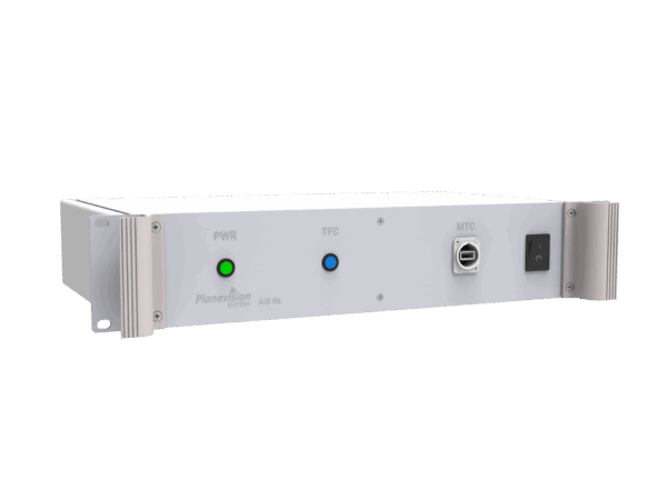
Our products for AIS
-

VesselTRack
VesselTRack for AIS is part of a family of professional 1U/2U, 10/19-inch rack-mounted ground station kits designed for cost-effective industrial and defense (naval) surveillance applications.